


Visit Citychrone.org website for more details!
A NEW VISION OF THE CITY
Citychrone measures cities on the basis of travel times instead of distances. It provides in this way a new vision of the city, closer to the perception and experience of citizens. In doing so it implements a vision of a city freed of private transport, evaluates the quality of public transport and allows to design and evaluate new scenarios for the accessibility of sites and services.
TIME YOUR CITY
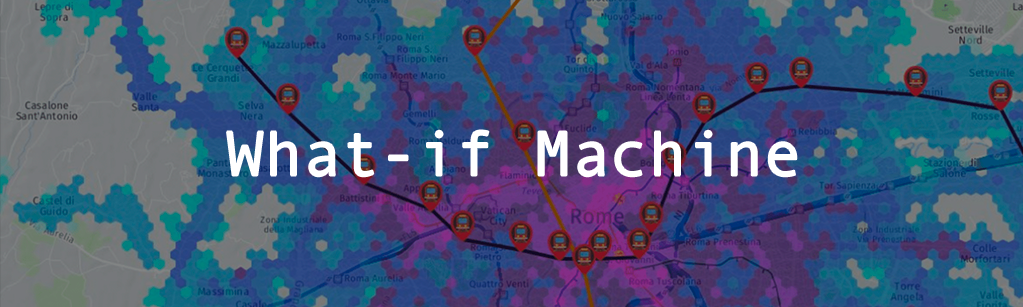
Thanks to the availability of information on public transport, CityChrone creates navigable maps of the urban fabric on the basis of travel time. And thanks to the modeling of urban traffic dynamics, allows to design new transport infrastructure (such as new metro lines) and simulate their impact on the accessibility and on journey times. You think you know how to improve your city? You can prove it!
CUSTOMIZED SIMULATIONS
If you represent an institution (city, province, region, ministry, etc.), a company or organization active in the field of mobility or interested in improving the accessibility of a specific territory and its services, CityChrone can help you with a critical assessment of the current situation and a planning for optimal solutions for the future. CityChrone team offers personalized advice thanks to the unique combination of expertise in the analysis of large amounts of data, the modeling of complex systems and the development of interactive ICT platforms. Contact us to learn more and request a free evaluation of CityChrone applied to your context.